
In this installment I'd like to share with you a quick accelerated hill training plan I devised for Flashette, aka Cathy, my scintillating cycling wife. She recently got the bug to hill climb and enlisted my aid to train her up. I've done this with her before, and at that time the rides were up to the Montclair/Tunnel road areas, and usually took 2-3 hours to complete. I've got two days off during the week this summer, so in addition to all the things that need to get done on those 2 days, and meshing our two schedules to ride together, I came up with an idea to get her the maximum climbing in the shortest amount of time. Like in an hour.
I've recently been exploring the Cleveland Heights area of Oakland, which is bordered by Lakeshore on the west, MacArthur on the north, and Park Blvd. on the south. This large triangle is built on a hill 162' in elevation and features up and down streets with grades, in my estimation, of up to 20% or higher!

The Cleveland Heights area of Oakland (click for larger view)
The neighborhood streets twist and turn, run up and down, and it is possible (today's ride) within 30 minutes to gain 800' of climbing in as little as 4 miles of up and down riding. Consider that the rule of thumb for hillage is that 100' climb per mile is a good effort, so we are climbing about 400% above that mark. Consider also that half of that 4 miles is downhill, so we are really gaining 800' in 2 miles! This is a tremendous workout up some hills ranging from mild to extremely steep. Flashette regularly reaches her max heartrate of 160...me, somewhat less, so I climb most of them in my 39 chainring for added benefit. Again, be reminded that the tallest point of this area is only 162' above sea level!
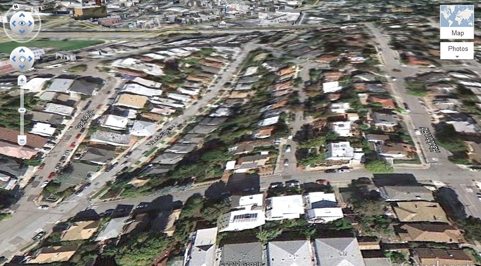
The street running left to right is Cleveland, its steeper than Google Earth represents it, I would guess at least 20% if not higher
Today's ride was 10 miles, 800' of climbing, in just over an hour. The distance to and from Alameda to the first hill is about 3 miles each way. So I'm pretty stoked by this new, very close training area. We both get a great workout in the same amount of time it takes to do a flat leisure ride in Alameda. And I'm becoming very familiar with a new area which I'm sure will be featured soon on Team Alameda rides.

Flashette, Flash, and Paula (hidden) at the top of Butters Canyon (900') recently on TA group ride...the plan is working! (photo: Dr. Bruce)
So I've come to see that short, intense efforts can have great dividends, and if you are time constrained you can still get in a worthy ride in on hour or so. And I've got a sated riding partner---icing on the cake! Give it a try!
Keep on Pedaling,
Flash
Now, ya' have me interested in these hills close to home. Thanks for explaining the proximity. Any chance you could add the exact routes in your blog in the future. ;-) Pretty please.
ReplyDeleteYour lovely wife couldn't have a better trainer for the hills.
Go Cathy Go!
Debi, no exact route, its random, so start at the bottom of Athol across the street from the lakeside tennis courts, and climb to the top. From there start exploring all the side streets. Just have fun. Flash
ReplyDeleteWonderful blog & good post.Its really helpful for me, awaiting for more new post. Keep Blogging!
ReplyDeleteFunction Point Estimation Training
ReplyDeleteHi there, awesome site. I thought the topics you posted on were very interesting.
Function Point Estimation Training